
This post is one of a series of blog posts covering my independent research on previously unidentified locations depicted in John Singer Sargent pieces. Pieces are identified using their Yale University Press ID numbers, as published in the series John Singer Sargent: The Complete Paintings, co-authored by Richard Ormond and Elaine Kilmurray. All findings are my own, represent my own opinions, and were reached using a combination of my own intuition & various publicly available tools, such as Google Maps & Google Street View.
This post covers the location depicted in John Singer Sargent’s piece titled “Venice” (Yale 1082), a beautiful watercolor featuring a mysterious “corner” of Venice
Here is the piece in question:
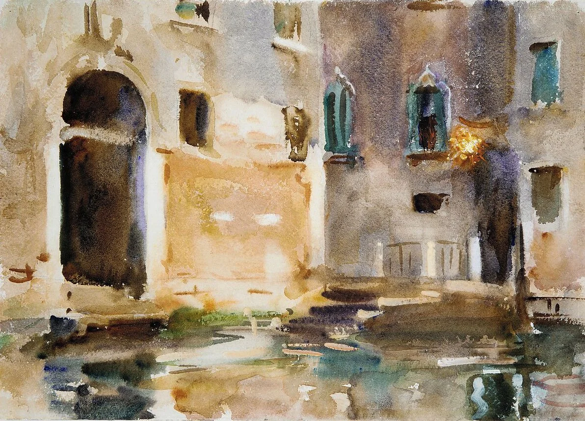
In my opinion, the painting was created at the L-shaped intersection of Rio de Santa Sofia and Rio Ca' Dolce in the Cannaregio sestiere, from the Rio Ca' Dolce looking south. Here's an approximate Google Street View:
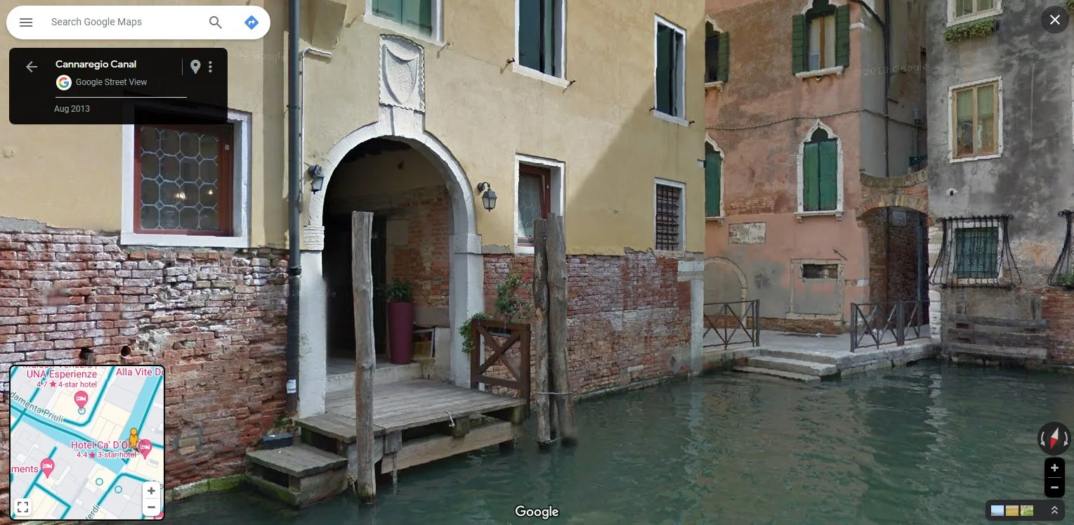
The architectural features and rhythms are unmistakable, down to the architectural features above the arched opening to the left and the small window near street level in the central building that seems to have been partially blocked up (the very dark horizontal rectangle above the steps). Once again, the apparently unmatching colors of paint can be ignored.
The presence of a narrow space separating the middle building from that on the left is noticeable, but I was doubtful the gap was due to the presence of a canal - the small landing with steps in the foreground of the painting appears to lead directly into the dark arched opening to its right, obstructing any access to water beyond, so I determined an alleyway or plaza should be the feature creating such a gap.
Using this information, as well as the perpendicular arrangement of the buildings, I assumed either the scene depicted the dead end of a canal (a rare event in Venice), or more likely, that a canal extended to the right, off the page, creating a right angle bend, as seen on the map inset.
Date of identification: 1/16/2024, reported to the authors on 1/21/2024
